
The Kimberley region in Western Australia
There are 3 travelled routes exploring
the Kimberley Region
Route One
The Gibb River Road
Unsealed road - Opens tradionally speaking mid to late April
(it may open earlier in sections only till the Pentecost River
and Durrack River crossings) and closes late November to early
December each year dependant on weather patterns.
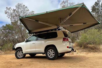
For 4wd car and 4wd campers. Now not all 4x4 rental companies
allow their 4wd's on the Gibb River Road see Australia4wdrentals
for the right Kimberley 4wd hire from Darwin, Broome or Perth.
Route Two
The Great Northern Highway from Kununurra to Broome.
Take the sealed highway route from Kununurra to Broome via Halls
Creek and Fitzroy Crossing. In Kunurra you can purchase scenic
air flights to the bungles.
For 2wd campervan hire, 2wd RV motorhome hire, 4wd car and 4wd
campers.
Route Three
The Gibb River Road back along the Great Northern Highway loop
trip.
Start in Broome or Darwin and drive via the Gibb River Road
back along the Great Northern Highway.
For 4wd car and 4wd campers.
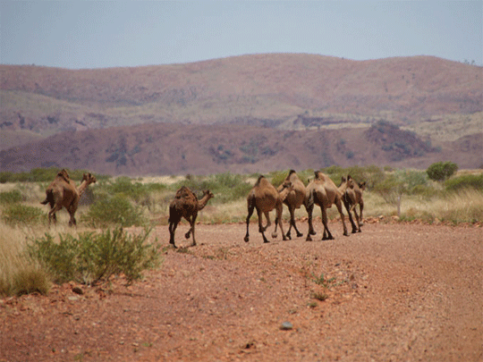
The Kimberley in Australia is one of the last true wilderness
areas on Earth, with rustic unique outback landscapes and landmarks
billions of years in the making. Covering app 423,000 square
kilometres in north Western Australia and with a population
of less than 40,000 people, it’s here you’ll encounter some
of the most extraordinary outback adventuresand folks in Australia.
Discover ancient gorge country with hikes and trekking a must
in planning your Kimberley vacation to enormous cattle stations,
pristine coastline and sandy beaches, to one of the oldest cultures
on the planet and the world’s only horizontal waterfalls.
The Kimberley region is Western Australia's most
northern region. The region encompasses an area of 421,451 square
kilometres or approx. 162,580 miles (one-sixth of the state's
total land area). The coastline faces the Indian Ocean to the
west and the Timor Sea to the north, while inland it is bordered
by the Great Sandy Desert in the south and the Northern Territory
in the east.
The Kimberley is called The Kimberley rather than the commonly
used The Kimberley's.
Western Australia and National Parks
(WA) towns, rivers, roads, crossings, stopovers and places of
interest (WA)
Map
of the Kimberley Western Australia
Explore the Kimberley on your own
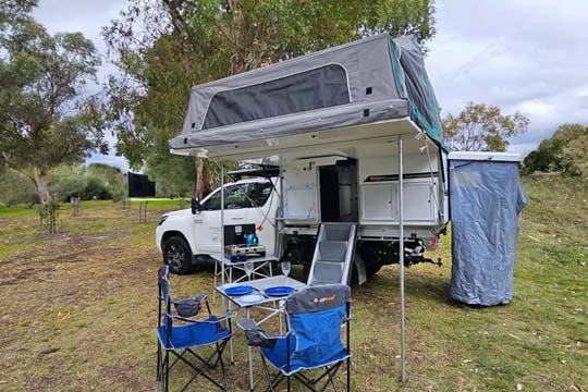
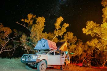
Explore the Kimberley in a 4wd camper allowed on the unsealed
roads (often referred to as offroad) in Western Australia. Start
your self drive holiday from Broome, Darwin or Perth with a
experienced local supplier.

Explore the Gibb River Road in the Kimberley
region of Australia
Self drive along the Gibb River Road from Broome or
Darwin is a Australia four wheel drive hire camper or wagon.
The Gibb River Road was initially constructed as a beef road
to transport cattle from the surrounding stations to the ports
of Derby and Wyndham.
It spans some six-hundred and seventy kilometres from Derby
to the junction of the Great Northern Highway between Wyndham
and Kununurra.
On passing through a gap in the Napier Range, the majesty of
the King Leopold Ranges comes into view.
Climate: 2 seasons in this part
of Western Australia:
Dry/Winter (April to September): Little rainfall with
mild to warm conditions Average temperatures are maximum 30°C
- 32°C, minimum 5°C - 12°C Humidity levels are low, averaging
between 30% - 40% in July
Wet/Summer (October to March): Heaviest rain
falling from January onwards, average 200mm in January. Average
temperatures are maximum 45°C, minimum 18°C - 22°C Humidity
levels averaging between 60% - 75%
Distances are vast: Each distance is approximately
suggested (variables) use your Gibb
River Road Outbacktravellers map or Kimberley
Hema map for accurate distances.
Distance from Gibb River Road is approximately a 772km drive
Distance from Gibb River Road Derby and ends in Kununurra is approximately
a 670km drive
A distance of six-hundred and seventy kilometres from Derby to
the junction of the Great Northern Highway between Wyndham and
Kununurra
Distance from Katherine to Kununurra is approximately a 570km
drive
Distance from Kununurra to Broome is approximately a 1,134km drive
via the Great Northern Highway (variables)
Distance from Kununurra to Broome is approximately a 880km drive
via the Gibb River Road (variables)
Distance from Broome to Perth is approximately a 2620km drive
via the coastal highway (variables)
Distance from Kununurra to the start of the Gibb River Road is
approximately a 180km drive
via National Highway 1 and Gibb River-Wyndham Rd
http://kimberleywesternaustralia.com/distances-in-kimberley-western-australia.htm
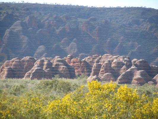
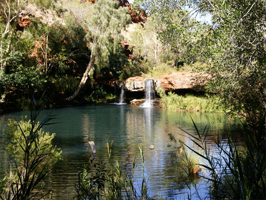
Explore Bungle Bungles region in Australia
Bungle
Bungle Region Purnulula National Park (Bungle Bungle)
Echidna
Chasm
Mini
Palms
Cathedral
Gorge
Turkey
Creek Roadhouse
Mabel
Downs Station
Explore El Questro in Western Australia
El
Questro
Emma
Gorge Trail
El
Questro Gorge Trail
Amalia
Gorge Trail
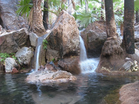
Zebedee
Springs
Saddleback
Ridge
Moonshine
Gorge Circuit Walk
Champagne
Springs
El
Questro Wilderness Park
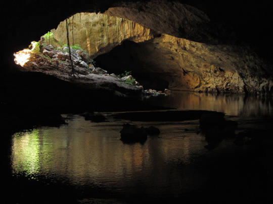
Explore the Gibb River Road Region in Australia
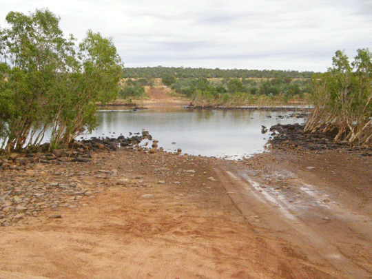
Pentecost
River
Durrack
River - Gibb River Road
King
Edward River Bradshaw
Paintings
Gibb
River Road
Ellenbrae
Station
Mt
Barnett Roadhouse
Manning
Gorge
Bell
Gorge
Dimond
Gorge & Sir John Gorge
Galvins
Gorge
Lennard
Gorge
Mt
Hart
Explore the Mitchell Plateau Region in Australia
Kalumburu
Drysdale
River Station
Home
Valley Station
Mitchell
River National Park
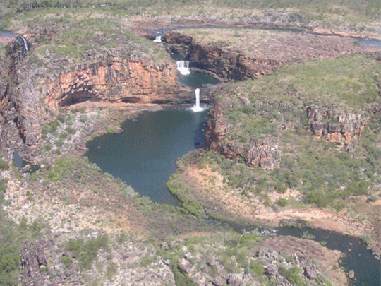
Mertens
Falls
Mitchell Falls Plateau
Mitchell
River
Bradshaw
Paintings
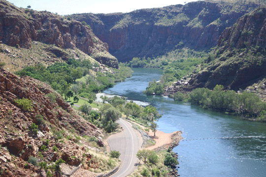
Explore the Kununurra Region in Australia
Kununurra
Lake
Argyle
Wyndham
Kalumburu
Home
Valley Station
WA
Border Quarrantine Station
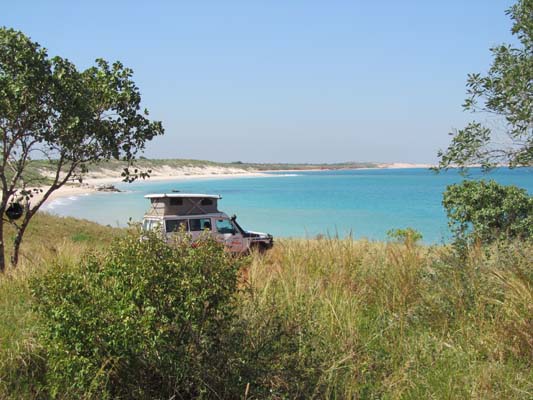
Explore the Broome region in Western Australia
Broome
Cape
Leveque
Explore beyond Broome in Western Australia
Cape
Leveque
Karijini
National Park
Explore the Great Northern Highway Region in Australia
Great
Northern Highway Kununurra to Derby to Broome
Fitzroy
Crossing
Halls
Creek
Old
Halls Creek
China
Wall
Lilly
Yard
Sturt
Creek
Turkey
Creek Roadhouse
Mabel
Downs Station
Purnulula
National Park (Bungle Bungle)
Explore the Great Northern Highway and Fairfields Leopold
Downs Road Region in Australia
Fairfields
Leopold Downs Road Region
From Fitzroy Crossing travel some 45klm towards Derby to the Fairfield
Leopold Downs Road turnoff.
Geikie
Gorge
King
Leopold Ranges
Windjana
Gorge
Tunnel
Creek National Park
Explore the Pilbara Region inAustralia
Pilbara
Region
Newman
Onslow
Tom
Price
Karijini
National Park
Marble
Bar
-
4wd Wagon hire -
 4wd camper family of 5
4wd camper hire for a family of May till October Broome and Darwin
Darwin 4wd camper
-
 4wd Adventure Camper
Sleep inside more room better kitted out Adventure camper rental
4wd camper Darwin