|
About the Mitchell Falls on the Mitchell Plateau off
the Gibb River Road in the Kimberley's in Western Australia
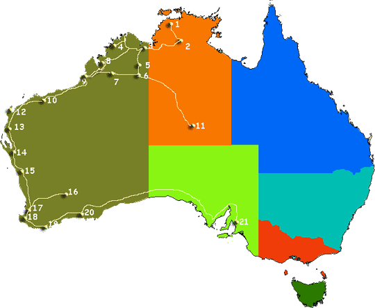
• The Kimberley in Australia is one of the last true
wilderness areas on Earth, with rustic unique outback landscapes
and landmarks billions of years in the making. Covering app 423,000
square kilometres in north Western Australia and with a population
of less than 40,000 people, it’s here you’ll encounter some of
the most extraordinary outback adventuresand folks in Australia.
Discover ancient gorge country with hikes and trekking a must
in planning your Kimberley vacation to enormous cattle stations,
pristine coastline and sandy beaches, to one of the oldest cultures
on the planet and the world’s only horizontal waterfalls.
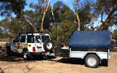
Self drive along the Gibb
River Road from Broome or Darwin is a Australia four wheel
drive hire camper or wagon. The Gibb River Road was initially
constructed as a beef road to transport cattle from the surrounding
stations to the ports of Derby and Wyndham.It spans some six-hundred
and seventy kilometres from Derby to the junction of the Great
Northern Highway between Wyndham and Kununurra.

Kalumburu and the Mitchell Plateau
Mitchell River National Park is a national park in the Kimberley
region of Western Australia (Australia), 2,140 kilometres (1,330
mi) northeast of Perth. The park adjoins the northern boundary
of the Prince Regent Nature Reserve. The nearest towns are Derby
which is 350 kilometres (217 mi) to the southwest and Wyndham
which is 270 km (168 mi) to the southeast. Access to the park
is achieved by 4WD only along the Mitchell Plateau Track from
the Kalumburu Road. The two main features of the park are Mitchell
Falls and Surveyors Pool. The park is biologically significant
and contains over 50 species of mammal, 220 birds and 86 amphibians
and reptiles, including the Saltwater Crocodile, King Brown snake
and Taipan. ©
source and courtesy of wikipedia.org
Kalumburu
Kalumburu is located on the banks of the King Edward River in
the far north of the Kimberley region of Western Australia. This
location was chosen because of the abundance of fresh water and
is only 15 kms from where the river empties into Napier Broome
Bay.
Access may be gained to Kalumburu by gravel road during the dry
season only. It is some 550 kms from Kununurra in the south east
and 650 kms from Derby in the south west. In addition, light aircraft
access from Kununurra or Wyndham is provided all year round, thanks
to an excellent airstrip at Kalumburu. Both these towns are some
hour and a half flying time.
The area experiences what is described as a dry, tropical climate,
with a cool, dry winter (May - September) and a wet, humid summer
(October - April). The average "wet season" rainfall is 48 inches
and is received as monsoon and thunderstorm downpours.
The community of Kalumburu is populated by approximately 400
people, mainly of aboriginal decent. There are approximately 25
non aboriginal residents who, together with those at the Mission,
provide essential services such as schooling, a health clinic,
a self service store and power and water.
Many tourists visit Kalumburu together with service providers
and government personnel, swelling the population, especially
during the dry season. There is a regular, twice a week mail service.
A health clinic is staffed permanently by two nursing sisters
and a doctor visits the town once a week. Eye specialists, dentists
and other professionals also make regular visits to Kalumburu.
Radio and television are also transmitted to the town. Entry Permits
are required for transit through Aboriginal Reserves, including
Kalumburu, and can be obtained from the Department of Indigenous
Affairs. Permits can
be applied for online under the Entry Permits section.
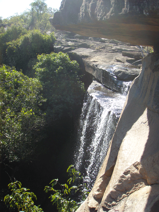
Mitchell Falls
One of the references to Mitchell falls walks on the Mitchell
Plateau is at www.gibbriverroad.net.
Travelling time: 1-2 days from Derby, Fitzroy Crossing or Kununurra.The
plateau is 350 kilometres north east of Derby and 270 kilometres
north west of Wyndham by air. Vehicle access is via the Mitchell
Plateau track (4WD only) from the Kalumburu Road, 172 kilometres
north of the Gibb River Road junction. The track may have washouts
and corrugations so drive with extreme care. Tracks north of the
airstrip are rough while track north of Anuauyu (Surveryors Pool)
are very rough and may be impassable. Tracks and raods may be
closed during the wet season (November to April seasonal conditions
apply). ©
source | courtesy of www.derbytourism.com.au
Things To Do:
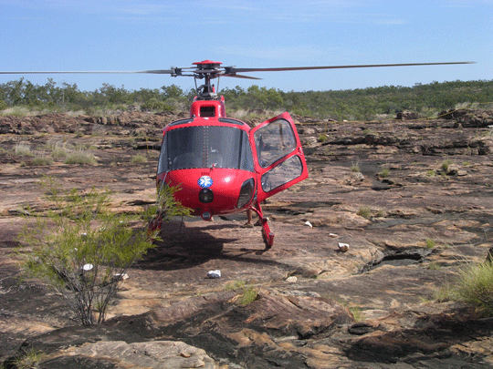
Walking, nature obseravation, scenic helicopter flights. Visitor
activities such as guided walks are held periodically: check with
the ranger.
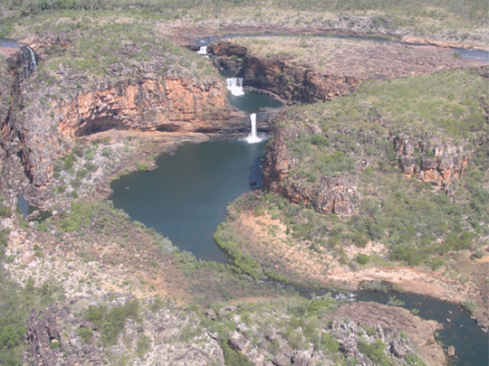
Punamii-unpuu - Mitchell Falls Walk
The 6km return walk to Punamii-unpuu (Mitchell Falls) from the
camping area is moderate to difficult as it traverses rock terrain.
Take care near the many cliffs. The track continues past Little
Mertens Falls and Big Mertens Falls.
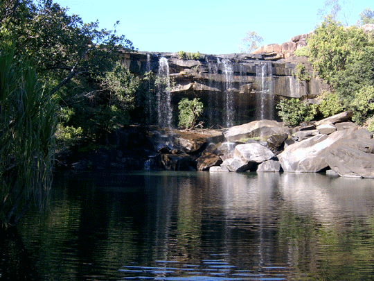
Aunauyu - Surveyors Pool Walk
It is an easy to moderate 8km return walk to Aunauyu (Surveyors
Pool) from the car park. Aunauyu is also an important place for
Wunggurr. The big white rocks found there are the eggs of the
snake.
Wunambal people know the falls as a powerful place for their
Wandjina-Wunggurr law and one of the main homes for Wunggurr.
They ask visitors to show respect, approach the area quietly and
stop for a moment to think about where they are.
Mitchell Falls Campground
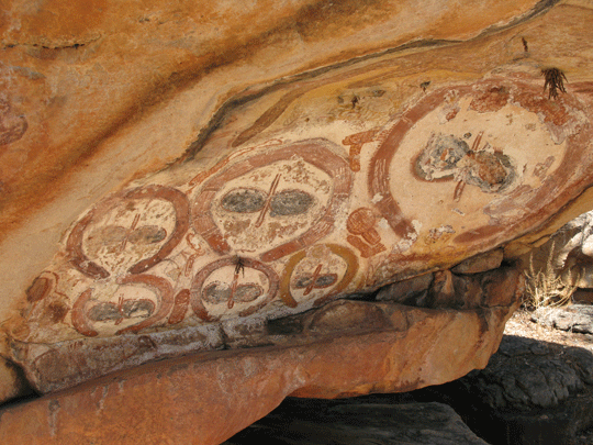
Mitchell River National Park lies in a remote part of the Kimberley
and contains majestic waterfalls, Aboriginal rock art and sites
of cultural significance to the Wunambal people. It is accessible
by four-wheel-drive vehicles only.
There are camping areas with toilets at Munurru (King Edward
River Crossing) and at Punamii-unpuu. It is advisable to boil
or treat water taken from creeks before drinking. Do not leave
food or rubbish unattended where animals can scavenge. Please
take your rubbish with you as there is no rubbish collection facility.
Collect firewood only from the designated firewood collection
zones. Use fuel stoves wherever possible and use firewood sparingly,
as dead wood is an important ecological resource. Camp fees are
now applicable and collected by Department of Environment & Conservation
(DEC) at the King Edward River campground on the road to Mitchell
River National Park. These fees will be collected on behalf of
the Kandiwal Aboriginal Corporation. Entry fees will be applicable
at Mitchell River National Park.
Separated into a generator area and an quiet area. Sites are
rather well spaced out with every site a fireplace. There are
toilets but no showers we saw.
The helicopter pad and it's reservation booking office is on
the perimeter of the camping area. Flights can be arranged there
if there is availability.
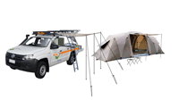
• Caravans are not permitted due to the road conditions, however
off-road camper trailers are allowed.
• Fire rings are provided but collecting wood in the national
park is not allowed.
• Limited wood is provided for cooking.
• Please do not bring your own wood as it can spread weed seed
and plant disease that can kill native flora.
• Light fires only in fireplaces provided.
• Preferably use your own portable gas or fuel stove. Sealed vault
pit toilets are provided.
• Water is available from a stream.
• Water should be boiled before use.
• Freshwater crocodiles are sometimes found in waterways.
• There is a 24-hour self-registration station available.
• Best time to visit: April to mid October.
• Bookings do not apply at this campground.
• It operates on a first come - first served basis.
• Please contact the campground during peak holiday season for
availability.
• Holders of Recreation Fishing licences may enter a park at no
charge if they are entering for the purpose of their licence -
licence to be shown on request.
© source and
courtesy of http://www.dpaw.wa.gov.au
Kalumburu Turn off to Mount Barnett
Where is it? Mt Barnett Roadhouse to Kalumburu is 107.5 klm estimated
time 4-6 hours careful driving depending on road conditiond (graded
or not and how soon after the wet season). Access to the park
is achieved by 4WD only along the Mitchell Plateau Track from
the Kalumburu Road. Going to Mitchell Falls allow for overnight
camping with no facilities at all there.
Where is it? 578 kilometres from Derby and 458 kilometres from
Kununurra.
Mount Barnett Roadhouse
About Mount Barnett Roadhouse in the Kimberley's in Western
Australia
• Address: Derby Gibb River Rd, Derby WA 6728, Australia
Phone: +61 8 9191 7007
16' 43'00.2 S
125'55'39.2' E
Mount Barnett Roadhouse is opposite the Kupungarri Community.
Mount Barnett Roadhouse is approximatley. 307 klm north of Derby,
400 klm from Kununurra. Turn-off is on the left hand side of the
road when travelling north. Mount Barnett Roadhouse fuel supplies
(both diesel and unleaded), Hot snacks, ice-creams, telephone,
drinking water, ice, toilets, showers, laundry, small store and
take-away and general stores, tyre repairs, Camp & entrance fees
are payable here to access the 7km long track leading to the Manning
Gorge camp site. Barnett River Gorge/Manning Falls and the campsite
- gorge and campsite are accessible via this track located 10
metres to the north of the roadhouse.
Upon payment of fee ask for a mud map of the hike/walk to the
Upper Manning Gorge where one can engulf themselves in the sights
and swim below pristine cooling waterfalls in a large rock pool
(be careful when swiming after drinking and eating), maybe you
can choise a outback bush campsite alongside the sandy edges of
one of the swimming holes.
Contact Information: Phone:(08)9191 7007
Imintji Roadhouse to Mt. Barnett Roadhouse is approx. 78 klm
- 86.2 klm (6klm from Station Creek)
Mt Barnett Roadhouse to Kununurra is approx. 400 klm estimated
time 10-12 hours careful driving
Mt. Barnett Roadhouse to El Questro Station is approx. 337 klm
Mt. Barnett Roadhouse to Derby is approx.307 klm
©
source | courtesy of www.derbytourism.com.au
©
source and courtesy of outbacktravellers.com.au
©
source and courtesy of wikipedia.org
© source
| courtesy of westernaustralia.com
|
 ©
© ©
©
 ©
©
 ©
©
 ©
©